Van bank naar bank

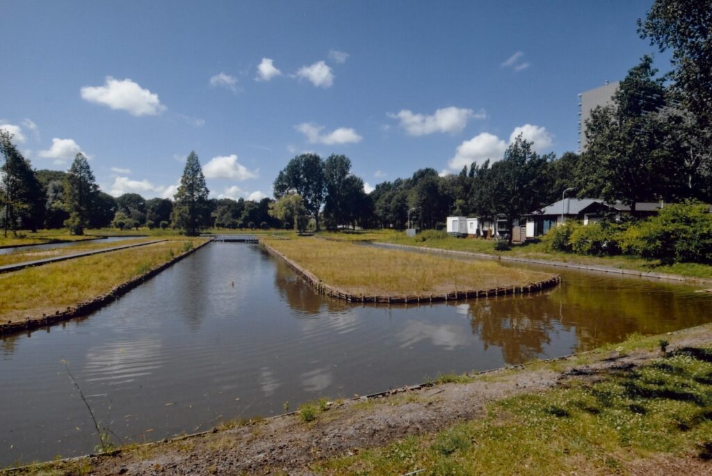
Burgemeester in ’t Veldpark

Nederlands English
In this park, which was named after Joris in ’t Veld who was the mayor of Zaandam before and after the Second World War, a small piece of the original “slagenlandschap” (landscape of plots) was reconstructed.
In the Iron Age, from 700 BC, the boggy moors around the Zaan were inhabited by people who lived on isolated farms on the sandy edges of tidal creeks, safely above the high-water mark. After the Roman occupation, that lasted only some 25 years around here, the lands were deserted because of rising water levels, after the estuary of the IJ or Northern Rhine (near – what is now – the town of Castricum) had silted up.

For the next couple of centuries, the area was only visited by hunters and fishermen and maybe some herdsmen in the summer months.

The first permanent occupation of the Zaan region started around the year 900. These people came from the higher grounds to the west and the east, where overcrowding and the sanding over of fields posed a major problem. Around this time the waters of the IJ had found a new route to the North Sea via the northeast, creating firmer ground in the peat marshes.

To get rid of excess water, the new farmers started by digging a ditch, parallel to a natural stream and some distance away from its boggy shores. From there, they would make canals at a right angle into the rising peat, ending in another parallel ditch to catch the water coming down from the top of the moor.

Doing so, they created rectangular stretches of land about thirty roods (115 meters) in width and six furlongs (1250 metres) long, called a “slag” (plot). A farm would be built on a suitable high spot and crops were planted around it, while the wet lower parts were being used as meadow land. One such “plot” would support an extended farming family.

However, drainage caused the peat to oxidate and shrivel away, so within a lifetime the land would become as boggy as it was before. The farmer or his descendants then would move to a new plot, higher up on the moor. In this second phase of exploitation, farms were lined up along the highest parallel ditch, forming the ribbon villages we can still see today in the flat landscape of reclaimed peat, characterized by hundreds of long, narrow ditches, which allow the water to drain from the land.

In this cosy corner of the In ’t Veld park, a miniature example of the medieval field system was recreated. You have to imagine the farms, the hard labour and the wet feet that went with it for yourself.